Frenchmans Cap
A white quartzite crown above Tasmania's wild south-west
- Region
- Franklin–Gordon Wild Rivers NP
- Length
- ~46 km return
- Duration
- 3–5 days
- High point
- 1,446 m (summit)
- Daily departures
- 18 max
- Registration
- Required (free, PWS)
Track booked out?

About the walk
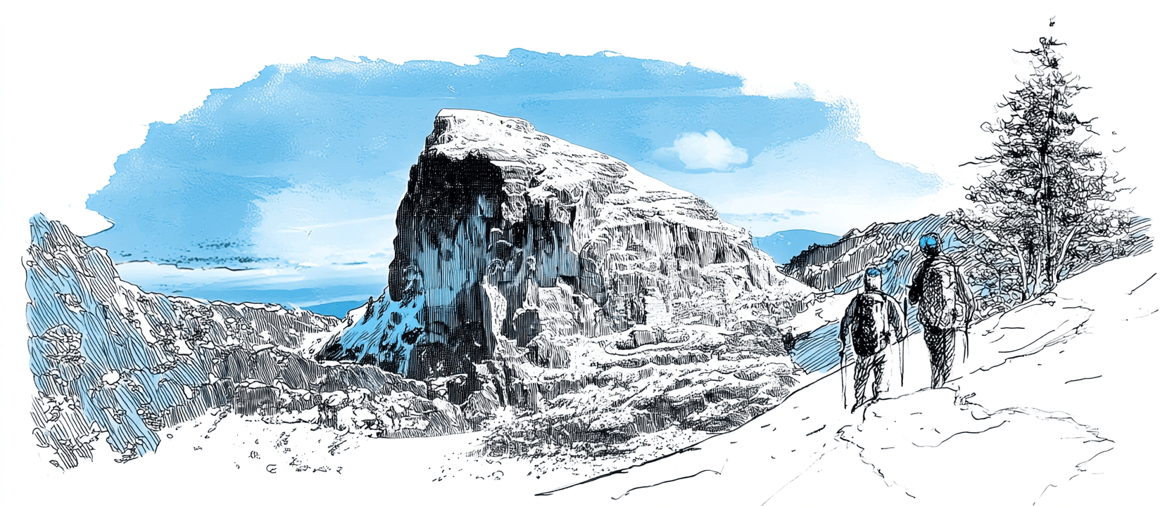
Frenchmans Cap is one of Tasmania's great mountain walks: a 3-to-5-day return journey into the heart of the Franklin-Gordon Wild Rivers National Park, climbing to a 1,446-metre summit of pale, glacier-scoured quartzite that stands clear above the surrounding wilderness. The white dome is visible from far across the south-west, and from the top, on a clear day, the view runs out over the Franklin River country to the Western Arthurs and beyond.
The track starts from the Lyell Highway and works in from the east: across the buttongrass plains, over the Loddon River, and up through rainforest to Lake Vera, then over Barron Pass and along to Lake Tahune beneath the summit cliffs. The final climb to the cap is steep but non-technical in good weather. Much of the lower track (once notorious for its bottomless mud, the "Sodden Loddon") has been rebuilt over the past decade, but this is still a serious walk in serious country.
Registration and the booking situation
Every overnight walker on Frenchmans Cap must hold a Parks and Wildlife Service walker registration for their start date. Registration is free, but it is not unlimited: the booking system caps each departure date at a maximum of 18 walkers, and you register for a specific start date and party size. It exists both for walker safety and to keep numbers on the track sustainable.
Most of the year there is room, but the good-weather windows concentrate demand. A run of fine summer days, a long weekend, or a settled forecast after a wet spell can push a popular date close to its cap of 18, or right up to it. When that happens, your date shows as full and you're left refreshing the page hoping someone drops out.
And they do drop out. Plans change, forecasts turn, group sizes shrink, and places quietly free up as a date approaches. The trouble is that a freed place is taken by whoever happens to be looking at that moment.
That's what Spotbagger watches for. We check the PWS walker registration page for Frenchmans Cap every few minutes and alert you the moment a date you want has room for your whole party, so you can register before the place is gone again.
Seasons and conditions
The usual walking season is summer and early autumn (December to April), when days are longest and the high country is most often clear. Even then, Tasmania's south-west is one of the wettest, most changeable places in the country: rain, wind, and cloud can arrive at any time of year, and snow is possible on the tops even in summer.
The exposed sections (Barron Pass, the climb to the summit, and the lake basins beneath the cliffs) can turn cold and white-out quickly. The summit push is best saved for a clear, settled day; many walkers build a spare day into the trip and wait at Lake Tahune for the weather to lift rather than commit to the cap in cloud.
Outside the main season the walk becomes a genuine alpine undertaking: short days, snow, and swollen river crossings. It is for experienced, well-equipped parties only.
Huts
There are two walkers' huts on the route, both beside lakes and both free to use with your registration: Lake Vera Hut (the usual first night, in the rainforest) and Lake Tahune Hut (below the summit cliffs, the base for the final climb). Each has bunk space, a rainwater supply, and a composting toilet.
Bunks are not allocated and cannot be reserved: they are first-come, and the huts can fill in peak periods or bad weather. Carry a tent. There are tent sites near both huts, and in poor conditions or a busy spell you may need them. The huts are for shelter and sleeping only: there is no power, no cooking fuel, and no food.
Gear essentials
This is alpine Tasmania, where the weather does the testing. The short list:
- Rain jacket and overtrousers: genuinely waterproof hard-shell, not water-resistant
- Tent: huts can be full; you must be self-sufficient for shelter
- Warm layers: fleece or down, plus hat and gloves, even in summer
- Sleeping bag and mat: huts have bunks but no bedding; bring a bag rated for cold nights
- Stove and fuel: no cooking facilities in the huts
- Sturdy boots and gaiters: for wet rock, roots, and the remaining muddy stretches
- Map, compass and PLB: this is remote country with no phone coverage; carry them and know how to use them
PWS publish a recommended gear list with the walker registration; read it before you finalise your pack.
Getting there
The walk begins at the Frenchmans Cap car park on the Lyell Highway (A10), between Derwent Bridge and Queenstown, roughly a 2.5-hour drive from Hobart or a little under two hours from Strahan. There is no public transport to the trailhead, so most walkers self-drive and leave a vehicle at the car park for the duration.
You'll also need a Tasmanian parks pass for the national park (separate from the free walker registration), and you should fill in the walker-registration logbook details before you set off. Lock in your start date and your registration as soon as your plans and the forecast line up; in peak season the popular dates are the first to reach their cap.
Common questions
Do I need to book Frenchmans Cap?
Yes. Every overnight walker needs a PWS walker registration for a specific start date and party size. Registration is free, but each departure date is capped at 18 walkers. You'll also need a Tasmanian parks pass.
My start date is full. Can I still get a place?
Often, yes. Plans and forecasts change, and places quietly free up as a date approaches; the trouble is they go to whoever happens to be looking. Set up a watch and we'll alert you the moment your date has room for your whole party.
Can I book a bunk in the huts?
No. Lake Vera and Lake Tahune huts are free to use with your registration but first-come, and they can fill in peak periods or bad weather. Carry a tent.
When is the best time to walk?
Summer and early autumn (December to April), when days are longest and the tops are most often clear. Save the summit push for a settled day; many parties keep a spare day at Lake Tahune for exactly that.
Other tracks we watch
Overland Track
Cradle Mountain–Lake St Clair National Park, Tasmania, Australia
Milford Track
Fiordland National Park, Southland, New Zealand
Routeburn Track
Mount Aspiring & Fiordland National Parks, Otago & Southland, New Zealand
Kepler Track
Fiordland National Park, Southland, New Zealand
Heaphy Track
Kahurangi National Park, Nelson Tasman & West Coast, New Zealand
Hollyford Track
Fiordland National Park, Southland, New Zealand
Western Arthurs
Southwest National Park, Tasmania, Australia
Can't get a booking?
We'll watch for you.
Spotbagger checks the Frenchmans Cap booking page every few minutes. The moment a spot opens, we'll tell you.