Eastern Arthurs
Tasmania's most serious traverse, ending on the spire of Federation Peak
- Region
- Southwest National Park
- Length
- ~65 km traverse
- Duration
- 6–9 days
- Grade
- Grade 5 (very experienced)
- Daily departures
- 6 max
- Registration
- Required (free, PWS)
Track booked out?
About the traverse
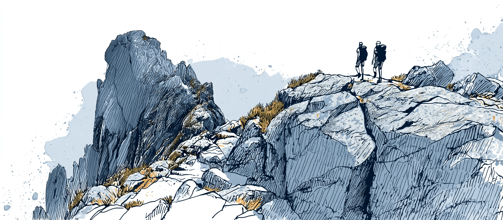
The Eastern Arthur Range Traverse (the EART) is, by wide agreement, the hardest of Tasmania's great traverses, and it saves the hardest part for last: the ascent of Federation Peak, the fanged quartzite spire that Sir Edmund Hillary called the only mountain in Australia that looked like a real mountain. The route runs the crest of the Eastern Arthur Range for the better part of a week before it puts you on the airy final climb to the summit, then brings you back out the way you came.
This is a Grade 5 walk in the most serious sense the grade allows: around 65 km over 6 to 9 days, on a route that is steep, frequently unmarked, and heavily exposed, with rock scrambling and pack-hauling on the harder pitches and cliff sections so steep that a slip has real consequences. There have been fatalities on the peak. It is for very experienced, self-sufficient parties only, confident with map and compass in poor visibility and prepared to sit out weather for days. The nearby Federation Peak Return via the Farmhouse Creek Track is the shorter out-and-back to the same summit; the full range traverse is a longer, more committing undertaking.
Registration and the booking situation
Every overnight walker on the Eastern Arthurs must hold a Parks and Wildlife Service walker registration for their start date. Registration is free, but it is not unlimited: the booking system caps each departure date at a maximum of 6 walkers, and you register for a specific start date and party size. It exists for walker safety and to keep numbers sustainable on a fragile alpine route.
Six places a day is very few. The walking window is narrow, settled-weather spells are rare, and a good summer forecast or a holiday period can push a popular start date up to its cap. Peak dates go first: New Year and the Christmas week are often the tightest of the season. When your date shows as full, you're left refreshing the page and hoping someone drops out.
And they do drop out. The Eastern Arthurs is a heavy commitment, and plans change constantly: forecasts turn, parties lose a member, trips get deferred to next season. Places quietly free up as a date approaches. The trouble is that a freed place is taken by whoever happens to be looking at that moment.
That's what Spotbagger watches for. We check the PWS walker registration page for the Eastern Arthurs often and alert you the moment a date you want has room for your whole party, so you can register before the place is gone again.
Seasons and conditions
The usual season is summer and early autumn (December to April), when the days are longest and the tops are most often clear. Even then, the south-west is one of the wettest, most exposed corners of Australia: rain, gale-force wind, cloud, and snow are all possible on the range at any time of year, and the quartzite turns lethally slick when wet.
The range gives you almost nowhere to hide, and Federation Peak least of all. The summit climb is only sane in good conditions, so most parties carry spare days and wait at camp for a clear window rather than commit to the exposed final pitches in cloud or wind. Weather dictates the whole trip. Outside the main season this becomes a full alpine expedition and is for expert, well-equipped parties only.
Camps and water
There are no huts on the Eastern Arthurs: every night is a tent night, and your shelter is what you carry. The classic camps string along the range: Pass Creek and Cutting Camp on the way up, Stuart Saddle and Goon Moor along the crest, and Hanging Lake in its cirque below the summit block, the usual launch point for the climb of Federation Peak. Pads are limited and exposed; pegs hold poorly in the thin alpine soil, so carry good guys and be ready to weight your tent with rock.
Water comes from the tarns and creeks and is generally reliable in season, but the high camps are fragile: keep well back from the water's edge, use the provided toilets or pack out where there are none, and tread the established pads to protect the cushion-plant and moss. Fuel stoves only; there is no firewood and fires are not permitted.
Gear essentials
This is exposed alpine Tasmania with a serious summit at the end and no bail-out. The short list:
- Rain jacket and overtrousers: genuinely waterproof hard-shell, not water-resistant
- Four-season tent: huts don't exist here; your shelter must take wind and rain on an exposed pad
- Warm layers: fleece or down, plus hat and gloves, even in summer
- Sleeping bag and mat: rated for cold, wet alpine nights
- Stove and fuel: no fires, no firewood; carry enough for the whole trip
- Sturdy boots and gaiters: for wet quartzite, scrambling, and the muddy plains
- Map, compass and PLB: the track is unmarked and there is no phone coverage; carry them and know how to use them
PWS publish a recommended gear list with the walker registration; read it before you finalise your pack.
Getting there
The traverse most often begins from the Farmhouse Creek trailhead, at the end of the forestry roads south of Geeveston, roughly a 2-hour drive from Hobart. There is no public transport to the trailhead, so walkers self-drive and leave a vehicle for the duration, or arrange a private shuttle from Hobart.
From the trailhead the track climbs through forest to the range before the route turns along the crest towards Federation Peak, and the standard trip returns the same way. You'll also need a Tasmanian parks pass for the national park (separate from the free walker registration). Lock in your start date and your registration as soon as your plans and a settled forecast line up; with only 6 places a day, the good dates are the first to reach their cap.
Common questions
Do I need to book the Eastern Arthurs?
Yes. Every overnight walker needs a PWS walker registration for a specific start date and party size. Registration is free, but each departure date is capped at 6 walkers. You'll also need a Tasmanian parks pass.
My start date is full. Can I still get a place?
Often, yes. The traverse is a heavy commitment and plans change constantly: forecasts turn, parties shrink, trips get deferred. Places quietly free up as a date approaches. Set up a watch and we'll alert you the moment your date has room for your whole party.
How is this different from Federation Peak Return?
Both finish on Federation Peak. The Return is the shorter out-and-back up the Farmhouse Creek Track. The Eastern Arthurs is the full range traverse: a longer, more committing route along the crest that takes in the peak near the end.
How hard is it really?
Grade 5 at its most serious: steep, frequently unmarked, heavily exposed, with rock scrambling, pack-hauling, and a summit climb where a slip has real consequences. It's for very experienced parties who can navigate in poor visibility and stay self-sufficient for a week or more.
Other tracks we watch
Overland Track
Cradle Mountain–Lake St Clair National Park, Tasmania, Australia
Three Capes Track
Tasman National Park, Tasmania, Australia
Milford Track
Fiordland National Park, Southland, New Zealand
Routeburn Track
Mount Aspiring & Fiordland National Parks, Otago & Southland, New Zealand
Kepler Track
Fiordland National Park, Southland, New Zealand
Heaphy Track
Kahurangi National Park, Nelson Tasman & West Coast, New Zealand
Tongariro Northern Circuit
Tongariro National Park, Central North Island, New Zealand
Paparoa Track
Paparoa National Park, West Coast, New Zealand
Rakiura Track
Rakiura National Park, Southland, New Zealand
Whanganui Journey
Whanganui National Park, Manawatū-Whanganui, New Zealand
Abel Tasman Coast Track
Abel Tasman National Park, Nelson Tasman, New Zealand
Hollyford Track
Fiordland National Park, Southland, New Zealand
Frenchmans Cap
Franklin–Gordon Wild Rivers National Park, Tasmania, Australia
Walls of Jerusalem
Walls of Jerusalem National Park, Tasmania, Australia
Federation Peak
Southwest National Park, Tasmania, Australia
Western Arthurs
Southwest National Park, Tasmania, Australia
Mount Anne
Southwest National Park, Tasmania, Australia
Lake Rhona
Franklin–Gordon Wild Rivers National Park, Tasmania, Australia
Can't get a booking?
We'll watch for you.
Spotbagger checks the Eastern Arthurs booking page often. The moment a spot opens, we'll tell you.